Image of Rhinolekos

Description:
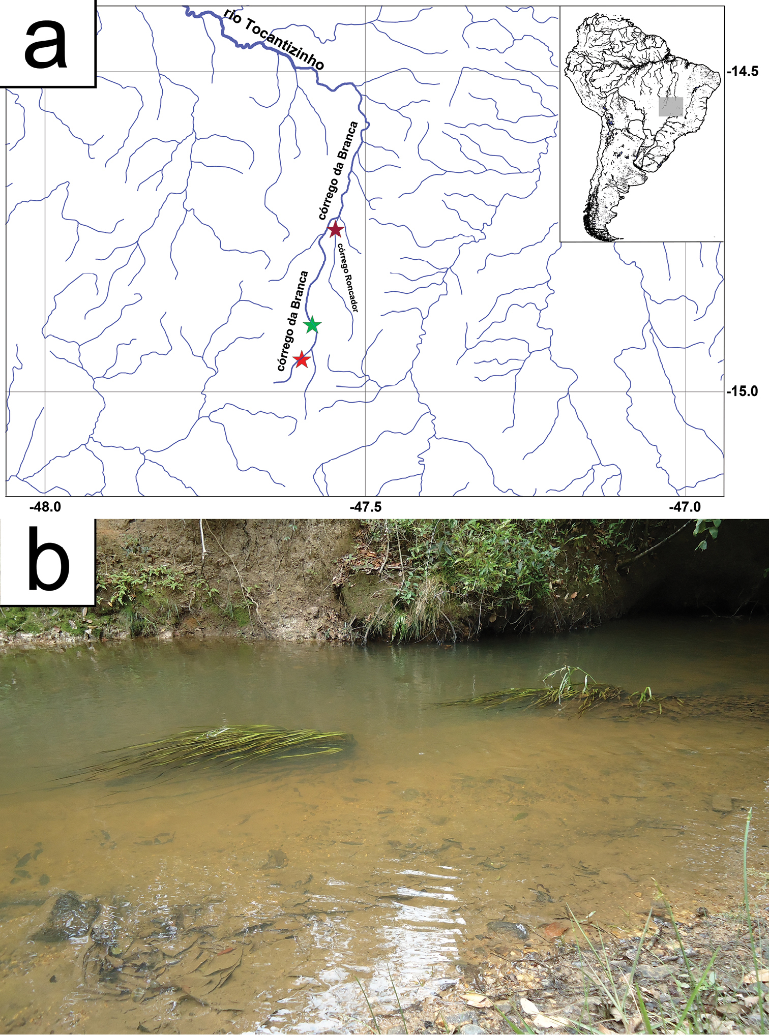
Figure 4.a Map showing the distribution of Rhinolekos capetinga. Type locality at córrego da Branca, green star – 14°53'47.2"S, 47°34'58.4"W. Paratype localities at córrego da Branca, red star – 14°57'01.6"S, 47°35'57.0"W, and at córrego Roncador, pink star – 14°43'51.3"S, 47°32'34.0"W b Habitat and submerged vegetation where the specimens were found in type locality of córrego da Branca, 14°53'47.2"S, 47°34'58.4"W. Photo: LH Roxo.
Included On The Following Pages:
- Life
- Cellular
- Eukaryota (eukaryotes)
- Opisthokonta (opisthokonts)
- Metazoa (animals)
- Bilateria
- Deuterostomia (deuterostomes)
- Chordata (Chordates)
- Vertebrata (vertebrates)
- Gnathostomata (jawed fish)
- Osteichthyes (bony fish)
- Actinopterygii (ray-finned fishes)
- Neopterygii
- Teleostei
- Otomorpha
- Ostariophysi
- Siluriformes (catfishes)
- Loricaroidei
- Loricariidae (suckermouth armored catfishes)
- Rhinolekos
- Rhinolekos capetinga
This image is not featured in any collections.
Source Information
- license
- cc-by-3.0
- copyright
- Fábio F. Roxo, Luz E. Ochoa, Gabriel S. C. Silva, Claudio Oliveira
- bibliographic citation
- Roxo F, Ochoa L, Silva G, Oliveira C (2015) Rhinolekos capetinga: a new cascudinho species (Loricariidae, Otothyrinae) from the rio Tocantins basin and comments on its ancestral dispersal route ZooKeys (481): 109–130
- original
- original media file
- visit source
- partner site
- Zookeys
- ID